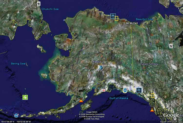
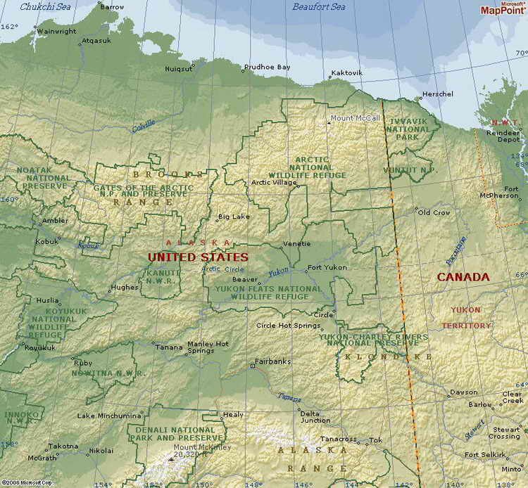
Mount McCall (Peak)
Located in northeastern Alaska's North
Slope County within the Romanzov Mountains of
the Brooks Range. Mount McCall is a mountain
summit and climbs to 8,199 feet (2,499.06 meters) above sea level. Mount McCall is
located at latitude - longitude coordinates (also called lat - long
coordinates or GPS coordinates) of N 69.285 and W -143.852222.

Mount McCall is situated near the coast of Canada's
Bufort Sea and just west of the Yukon Territory border
 |
John's early conquest
of Mr. McKinley and the now famous rescue as well as his unique
contributions to the early studies of glaciology have been recognized in
the naming of Mount McCall and McCall Glacier, both in northern Alaska.
McCall Glacier
Named in 1956 by R.C. Hubley for John Gill McCall,
glaciologist, University of Alaska, the glacier is at
Latitude:
69.30361, Longitude:
-143.84556 within the Romanzov
Mountains of the Brooks Range. These mountains are part of the Arctic
National Wildlife Refuge. This region of the Brooks Range swings far to
the North and is only 60 miles from the Arctic Coast.
Read
Lessons from McCall Glacier (Note: not to be confused with a
glacier of the same name in Washington State)
McCall Glacier today is about 6.5 km in area and faces mostly
north, towards the tundra and the Arctic Ocean coast near Barter Island,
Alaska, not far from the Yukon border. The Dictionary of Alaska Place
Names (Orth, 1967:607) lists the glacier as follows:
"McCall Glacier: glacier, heads on Mt. Hubley in Romanzov Mts., trends N
5 mi. to its terminus at head of McCall Creek, 10 mi. E of Mt.
Michelson, Brooks Ra.; 69[degrees]20' N; 143[degrees]49'W."
 -
(Photo credit - Dr. Matt
Nolan, University of Alaska, Fairbanks. -
(Photo credit - Dr. Matt
Nolan, University of Alaska, Fairbanks.
|